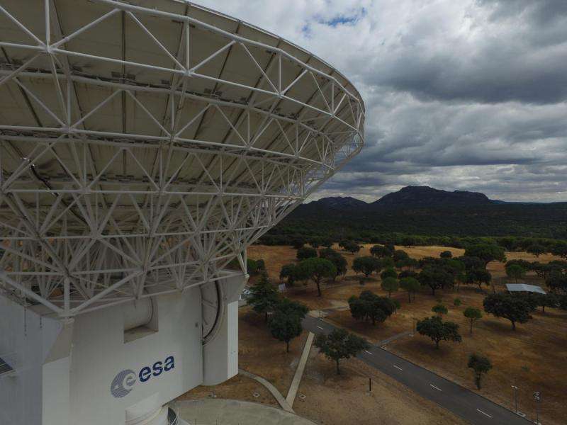
Image: Drone inspection of ESA's deep-space tracking station at Cebreros

Earlier this month, the team at ESA's deep-space tracking station at Cebreros, near Madrid, Spain, ran a series of test flights to image the antenna using a Dji Phantom 3 drone controlled with an iPad.
The team are trialling the use of a drone to perform routine maintenance inspections of the station's massive 35 m-diameter dish. It may also be effective for inspecting the site's fencing and other facilities.
We've cut some of the video they recorded into a half-minute teaser (see below), which provides excellent views of the gorgeous white station, the site and its buildings and the surrounding countryside.
"We really see the effect of the forest fire that occurred few years ago – there are no pine trees any more on the drive from the hill hosting the so-called 'calibration tower' to the antenna – and we can also see the benefits of our well-maintained firebreak, which saved the station during the same forest fire," says Lionel Hernandez, station manager.
ESA's Cebreros station sits 77 km west of Madrid. It provides routine communication with deep-space missions such as Mars Express, Gaia and Rosetta.
Provided by European Space Agency


