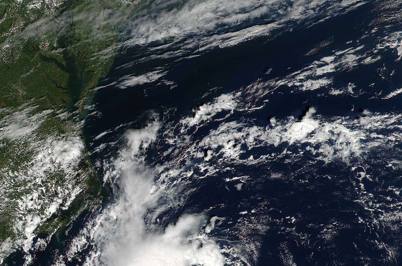
Satellites see Tropical Depression 8 off the North Carolina coast

ASA-NOAA's Suomi NPP and NOAA's GOES satellites showed Tropical Depression 8 nearing the North Carolina coast. An animation of satellite imagery showed the development and movement of the depression toward the coast over a two day period.
At 2:25 p.m. EDT (18:25 UTC) on Aug. 29, the Visible Infrared Imaging Radiometer Suite (VIIRS) instrument aboard NASA-NOAA's Suomi NPP satellite captured a visible image of Tropical Depression Eight off the North Carolina coast. The depression had a tight concentration of strong thunderstorms around its low-level center of circulation.
At NASA/NOAA's GOES Project office at the NASA Goddard Space Flight Center in Greenbelt, Maryland, an animation of NOAA's GOES-East satellite imagery from Aug. 28 to Aug. 30 was created. The animation showed the movement of Tropical Depression 8 near the Carolinas, and Tropical Depression 9 over Cuba.
On Aug. 30 a Tropical Storm Warning is in effect for the coast of North Carolina from Cape Lookout to Oregon Inlet Pamlico Sound
At 8 a.m. EDT (1200 UTC) on Tuesday, Aug. 30 the center of Tropical Depression Eight was located near 34.1 degrees north latitude and 75.1 degrees west longitude. That puts the center of the depression just 85 miles (135 km) south-southeast of Cape Hatteras, North Carolina.
NOAA's National Hurricane Center said that the depression is moving toward the north-northwest near 5 mph (8 kph). A turn toward the north is expected later today, and a turn toward the northeast is forecast on Wednesday. On the forecast track, the center of the depression will be near the Outer Banks of North Carolina today, Aug. 30, either this afternoon or this evening.
Maximum sustained winds are near 35 mph (55 kph) with higher gusts. Slow strengthening is forecast during the next 48 hours, and the depression could become a tropical storm later today.
NHC noted that the depression is expected to produce total rain accumulations of 1 to 3 inches with isolated maximum amounts of 5 inches over far eastern North Carolina, including the Outer Banks.
Provided by NASA's Goddard Space Flight Center


