NASA gets an eyeful of Hurricane Blas

Satellites eyeing powerful Hurricane Blas in the Eastern Pacific Ocean revealed a large eye as the powerful storm continued to move over open waters.
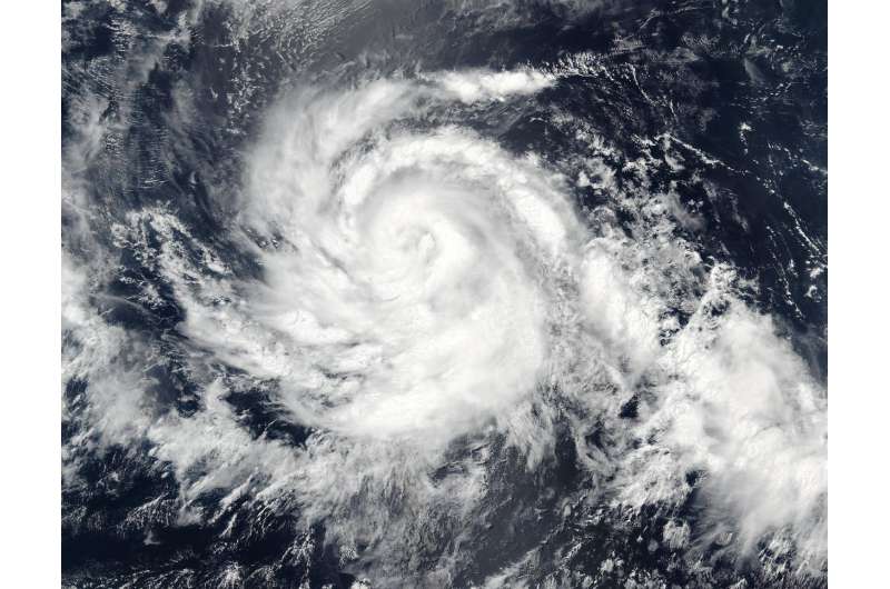
On July 4 at 20:50 UTC (4:50 p.m. EDT) the Visible Infrared Imaging Radiometer Suite (VIIRS) instrument aboard NASA-NOAA-DOD's Suomi NPP satellite captured a visible light image of Hurricane Blas that showed a developing, and cloud-filled eye.
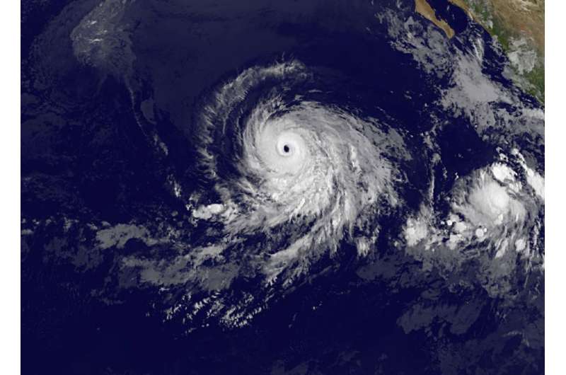
A visible image of Blas from NOAA's GOES-West satellite taken on July 7 at 1200 UTC (8 a.m. EDT) revealed the eye opened wide. GOES-West saw a large 25 to 30 nautical mile (28.7 to 34.5 mile/46.3 to 55.5 wide eye surrounded by a symmetric ring of thunderstorms. The imagery also showed little outer banding (of thunderstorms).NOAA manages the GOES satellites and the NASA/NOAA GOES Project at NASA's Goddard Space Flight Center in Greenbelt, Maryland uses data from them to create images and animations.
Infrared satellite data from July 6 revealed that Blas is currently in over sea surface temperatures of 27 to 28 degrees Celsius (80.6 to 82.4 degrees Fahrenheit). A tropical cyclone needs sea surface temperatures of at least 26.6 degrees Celsius (80 degrees Fahrenheit) to maintain intensity. Warmer temperatures assist in strengthening while colder temperatures help weaken a tropical system.

On Wednesday, July 6, 2016 at 11 a.m. EDT (1500 UTC), the center of Hurricane Blas was located near latitude 15.0 degrees north and longitude 123.6 degrees west. That's about 1,045 miles (1,685 km) west-southwest of the southern tip of Baja California, Mexico. Blas was located far from land so there were no coastal watches or warnings in effect. Blas was moving toward the west-northwest near 12 mph (19 kph), and this general motion is expected to continue over the next couple of days.
Maximum sustained winds are near 125 mph (205 kph) making Blas a category 3 hurricane on the Saffir-Simpson Hurricane Wind Scale. The National Hurricane Center (NHC) said that slow weakening is forecast tonight and Thursday, followed by a faster rate of weakening by Friday, July 8. The estimated minimum central pressure is 956 millibars.
The NHC noted after the next day or day and a half "Blas will be moving over sea surface temperatures below 26 Celsius (78.8 Fahrenheit) which should cause a faster rate of weakening, and the cyclone is forecast to become post-tropical in about 4 days."
Provided by NASA's Goddard Space Flight Center


