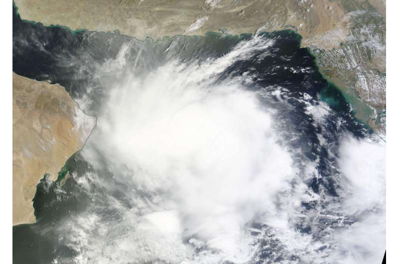
NASA spots Tropical Cyclone 02A develop in Arabian Sea

Tropical Cyclone 02A developed in the Northern Indian Ocean's Arabian Sea as NASA's Aqua satellite passed overhead and analyzed the storm in infrared light and NASA's Terra satellite captured a visible look at the storm.
On June 26, at the tropical cyclone was consolidating, NASA's Aqua satellite passed over the Northern Indian Ocean. The Atmospheric Infrared Sounder or AIRS instrument aboard Aqua captured infrared temperature data on the storm's cloud tops at 0905 UTC (5:05 a.m. EDT). That data was made into a false-colored infrared image at NASA's Jet Propulsion Laboratory in Pasadena, California. The AIRS data showed cold cloud top temperatures near minus 63 degrees Fahrenheit (minus 53 degrees Celsius) in storms around the center of circulation. Storms with cloud tops that cold indicate they are high in the troposphere and have strong uplift. NASA research has shown that cloud tops that cold are capable of dropping heavy rain.
On Monday, June 27, 2016 at 1500 UTC (11 a.m. EDT), Tropical Cyclone 02A was located near 21.7 degrees north latitude and 63.8 degrees east longitude in the Arabian Sea. It was centered about 249 nautical miles (286 miles/461 km) southwest of Karachi, Pakistan and was moving to the west at 7 knots (8 mph/12.9 kph). Maximum sustained winds were near 35 knots (40 mph/62 kph).
Earlier in the day, animated multispectral satellite imagery showed that the low-level circulation center was slowly consolidating, and there was strong convection and developing thunderstorms over the low-level center. NASA's Terra satellite passed overhead and the Moderate Resolution Imaging Spectroradiometer captured a visible light image of Tropical Storm 02A that seemed to fill up the northern part of the Arabian Sea. In the image, the western-most edge of 02A's clouds had reached Al Haad, in the easternmost coast of Oman.
The Joint Typhoon Warning Center said that an image from the NOAA-19 polar orbiting satellite at 1039 UTC (6:29 a.m. EDT) showed a curved band of thunderstorms over the western semi-circle wrapping into the western quadrant.
Tropical Cyclone 02A is forecast to track west to west-southwestward over the next two days and then slow down and turn southwestward to southward due to a strong subtropical ridge (elongated area of high pressure) entrenched over the Arabian Peninsula.
The system is forecast to reach a peak intensity of 50 knots (57.5 mph/92.6 kph) within a day or so and dissipate around June 30.
Provided by NASA's Goddard Space Flight Center


