NASA's 3-satellite view of powerful Tropical Cyclone Fantala

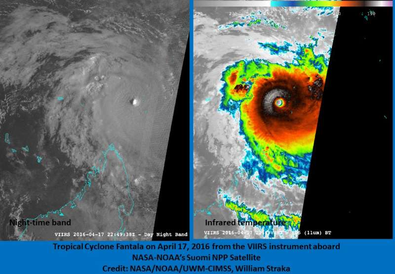
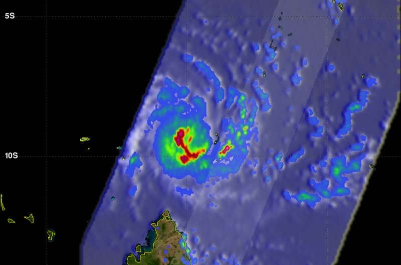
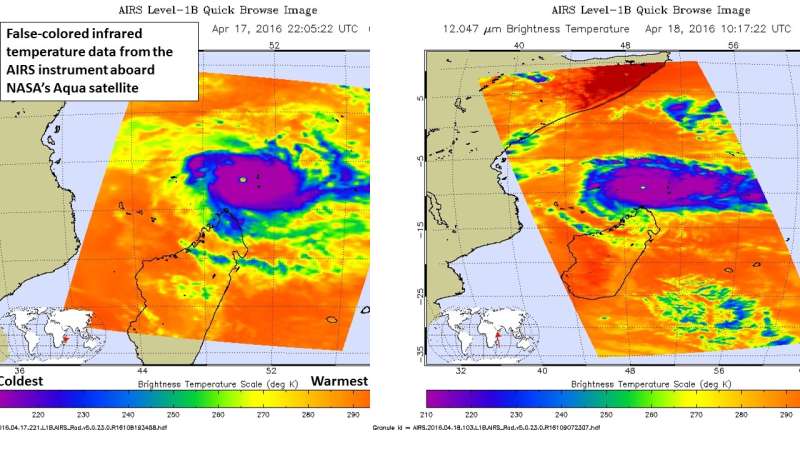
Three NASA satellites provided data on powerful Tropical Cyclone Fantala as it lingered north of Madagascar in the Southern Indian Ocean. NASA-NOAA's Soumi NPP satellite provided a night-time and infrared view, NASA's Aqua satellite provided a look at cloud top temperatures and extent, and NASA-JAXA's Global Precipitation Measurement or GPM core satellite measured the storm's intense rainfall.
On April 17, 2016 Fantala's estimated maximum sustained winds reached 150 knots (173 mph) making it the most powerful South Indian Ocean tropical Cyclone of 2016. This increase in intensity made Fantala a category five tropical cyclone on the Saffir-Simpson Hurricane wind scale.
NASA-NOAA's Suomi NPP Night-time View
Two images of Super Tropical Cyclone Fantala were taken from the Visible Infrared Imaging Radiometer Suite (VIIRS) instrument aboard NOAA-NASA's Suomi NPP satellite on April 17. A night-time view and infrared view both showed the 16-nautical-mile-wide eye. The infrared image was false-colored and showed powerful thunderstorms circling the center.
GPM Measures Rainfall, Cloud Heights
Fantala became this powerful while moving over the open waters of the South Indian Ocean to a position north of Madagascar. GPM's Microwave Imager (GMI) and Dual-Frequency Precipitation Radar (DPR) data were used to show the locations and intensity of precipitation within Fantala.
The GPM core observatory satellite flew above tropical cyclone Fantala's eye on April 16, 2016 when the tropical cyclone had winds of 130 knots (150 mph). At that time rain was measured by GPM's radar (DPR) falling at an extreme rate of close to 300 mm (11.8 inches) per hour in the southwestern side of Fantala's eye wall. The powerful storms located there were found by GPM's radar (DPR) to reach heights of almost 16 km (9.9 miles).

The GPM core observatory satellite had another fairly good view of extremely powerful tropical cyclone Fantala on April 18, 2016 at 0126 UTC (Apr. 17 at 9:26 p.m. EDT) when maximum sustained winds were estimated at 150 knots (173 mph). This satellite view showed that Fantala was dropping very heavy rain over large areas of the Indian Ocean north of Madagascar. Data from GPM's GMI were used to estimate that rain was falling at a rate of over 65 mm (2.6 inches) southwest of the tropical Cyclone's eye. GPM's radar (DPR) found rain falling at over 186 mm (7.3 inches) per hour in an intense feeder band on the eastern side of the tropical cyclone.
Aqua's AIRS Infrared Shows Powerful Storms
Two false-colored infrared images of Fantala from the Atmospheric Infrared Sounder or AIRS instrument that flies aboard NASA's Aqua satellite were taken on Apr. 17 and Apr. 18. In this infrared temperature data from both days, AIRS showed cloud top temperatures of thunderstorms in the storm's eyewall colder than -81.6 (-63.1C). These storms have the potential to generate heavy rainfall, which was identified in the GPM data.

By April 19, 2016 at 0900 UTC (5 a.m. EDT), Fantala finally weakened a Category 3 hurricane on the Saffir-Simpson Scale, from a Category 5. Currently, maximum sustained winds were near 105 knots (120.8 mph/194.5 kph) and continued to weaken. The storm has already curved to the east-southeast and was moving at 4 knots (4.6 mph/7.4 kph). It was centered near 9.3 degrees south and 50.0 degrees east, about 774 miles northwest of Port Louis, Mauritius.
The Joint Typhoon Warning Center noted that the storm will track to the southeast for the next couple of days before turning back to the west, and toward Madagascar.
Provided by NASA's Goddard Space Flight Center


