The fourth dimension

Remote sensing techniques facilitate observations and monitoring of ground displacements. In particular, space-borne Differential Synthetic Aperture Radar Interferometry (DInSAR) allows accurate measurements of ground deformation by properly analyzing multi-temporal satellite acquisitions over the region of interest.
However, limitations of DInSAR may arise when large and/or rapid surface deformation occurs, including those caused by active rifting. Understanding the three-dimensional characteristics of the deformation field, as well as its temporal evolution, cannot be accomplished by DInSAR alone.
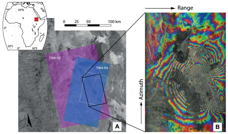
Accurate spatial and temporal dense information on the displacements is, however, crucial for the correct interpretation of complex geological phenomena. In this paper, Francesco Casu and Andrea Manconi propose an algorithm to retrieve the four-dimensional (i.e., along north, east, up, and time) surface deformation field over zones affected by active rifting.
In the Afar depression system, one of the locations worldwide where active rifting processes can be observed, Casu and Manconi retrieved information in areas where data was not previously recorded. Their method demonstrates its validity in complex situations such as rifting episodes, where the deformation associated to repeated intrusions, faulting, and lithospheric extension might overlap in space and time.
More information: Four-dimensional surface evolution of active rifting from spaceborne SAR data, http://geosphere.gsapubs.org/content/early/2016/04/07/GES01225.1.abstract
Provided by Geological Society of America


