Researchers confirm groundwater resources can support crops in the West Kimberley

Growing crops in the West Kimberley appears to be one step closer after recent findings that groundwater resources in the region will support agricultural development.
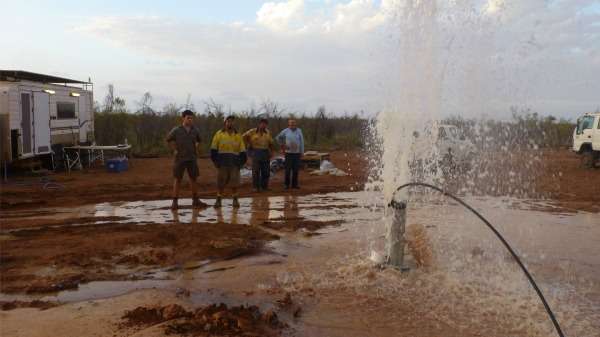
The recent drilling program across the La Grange aquifer, south of Broome, by the Department of Agriculture and Food WA (DAFWA) showed most of the water from the 26 drilled bores is of high quality and fit for most, if not all, horticultural and agricultural uses.
The 200m-thick sandstone aquifer has a salinity level mostly below 500 milligrams per litre, making it similar to or even less saline than drinking water.
The aquifer covers about 25,000 square kilometres, which is roughly four times the size of the Perth metropolitan area.
The program confirmed the La Grange aquifer likely holds at least 50 gigalitres of water—enough to fill about 20,000 Olympic-sized swimming pools.
This volume of water could irrigate up to 5,000 hectares of land in the La Grange region.
A recent report commissioned by the department suggests agriculture in the region could include a mix of beef and horticultural crops, particularly those favoured by the Asian and Middle Eastern markets such as sesame seeds, almonds and sorghum.
Groundwater in the region is already used to a small extent for the Bidyadanga community located south of Broome and some tourism and pastoral operations.
The drilling data will now be incorporated into a groundwater model, which will help potential agricultural operators identify the most appropriate sites for development.

"The model will be able to show us the consequences of taking water from the aquifer at any given location," DAFWA principal scientist Dr Richard George says.
These consequences could include, for instance, if and how the saltwater interface moves when water is extracted from a particular location.
"It will allow us to ensure that future development manages any interaction with cultural sites or the saltwater interface, or between neighbours."
Next year DAFWA will work with stakeholders to run various scenarios through the model.
In addition to pastoral station operators and two existing irrigators, the department worked closely with the Karajarri, Nyangumarta and Yawuru native title groups before and during the drilling program.
This led the department to use the bores to set up a long-term monitoring network, delivering what Dr George calls a "legacy of baseline data".
The three types of bores installed will assess over time the position of the saltwater interface, the recharge of the aquifer and how quickly the water in the aquifer is moving.
Provided by Science Network WA
This article first appeared on ScienceNetwork Western Australia a science news website based at Scitech.


