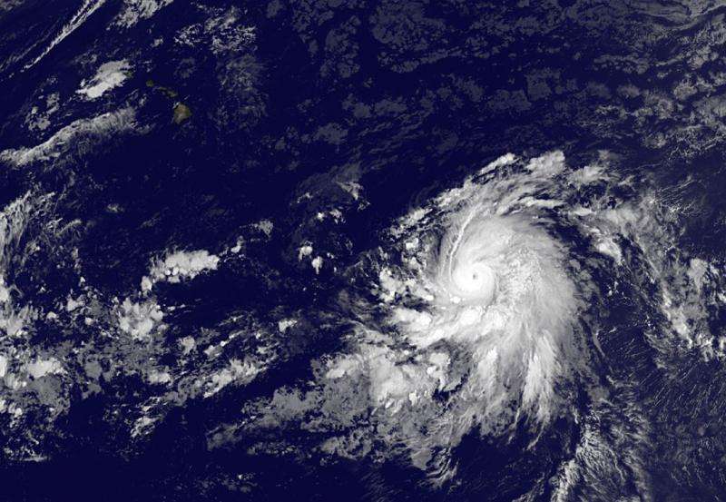
Satellite animation shows Olaf grow into a major hurricane

An animation of imagery from NOAA's GOES-West satellite over several days showed Hurricane Olaf become a major hurricane on Monday, October 19, 2015. NASA's GOES Project created the animation that compiled three days of GOES data.
The 35 second animation of infrared and visible imagery runs from October 16 through October 19. On October 19, Olaf had strengthened into a major hurricane. That's a Category three hurricane on the Saffir-Simpson Wind Scale. At the end of the animation on October 19, a small eye formed.
Olaf is located in the western area of the Eastern Pacific approaching the 140 degree latitude line, which marks the border with the Central Pacific. Olaf is expected to cross into the Central Pacific basin at night.
At 11 a.m. EDT (1500 UTC) on October 19 the eye of Hurricane Olaf was located near latitude 9.9 North and longitude 137.7 West. That's about 1,345 miles (2,160 km) east-southeast of Hilo, Hawaii. Olaf was moving toward the west near 14 mph (22 kph), and a turn toward the west-northwest is forecast at night followed by a west-northwestward motion through Wednesday, October 21.
Satellite imagery indicates that maximum sustained winds have increased to near 115 mph (185 km/h) with higher gusts. Olaf is a category 3 hurricane on the Saffir-Simpson Hurricane Wind Scale. Additional strengthening is forecast through tonight, with some fluctuations in intensity possible on October 20. The estimated minimum central pressure is 967 millibars.
Olaf is expected to curve northwest and move parallel from Hawaii by October 25 while remaining east of the islands. For updated forecasts, visit: http://www.nhc.noaa.gov/archive/2015/refresh/OLAF+shtml/145409.shtml.
Provided by NASA's Goddard Space Flight Center


