NASA satellite data shows Joaquin becoming a post-Tropical Cyclone

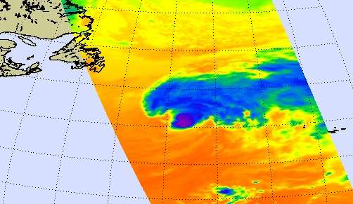
Infrared data from NASA's Aqua satellite showed Hurricane Joaquin weakening over cooler waters and transitioning into a post-tropical cyclone.An infrared image of Hurricane Joaquin was taken from the AIRS (Atmospheric Infrared Sounder) instrument aboard NASA's Aqua satellite on Oct. 7 at 15:41 UTC (11:41 a.m. EDT). The infrared data, which shows temperature, showed the highest, coldest clouds and the bulk of cold clouds were being pushed from the center to northeast of the center by westerly winds. Cloud top temperatures had also warmed since the previous day indicating weaker storms and less uplift in the air. AIRS infrared data also showed the sea surface temperatures were colder than the 80F (26.6C) required to help a tropical cyclone maintain intensity.
Because Joaquin lacked sufficient organized deep convection (and developing thunderstorms) to qualify as a tropical cyclone, at 11 p.m. EDT on October 7, the National Hurricane Center declared Joaquin as a post-tropical cyclone.
At 11 p.m. EDT on October 7 (0300 UTC, Oct.8), the center of Post-Tropical Cyclone Joaquin was located near latitude 42.0 North, longitude 37.0 West. That's about 595 miles (960 km) west-northwest of the Azores. The post-tropical cyclone was moving toward the east near 35 mph (56 kph), and this general motion is expected over the next couple of days. Maximum sustained winds have decreased to near 65 mph (100 kph) and additional weakening is forecast during the next 48 hours. The estimated minimum central pressure was 977 millibars.
National Hurricane Center forecaster Pasch said "Satellite imagery indicates that the system no longer resembles a tropical cyclone, with a disorganized area of multi-layered cloudiness sheared off well to the northeast of the ill-defined low-level center. However, model analyses and surface data indicate that the cyclone is not yet embedded within a frontal zone, and therefore is not extratropical at this time."
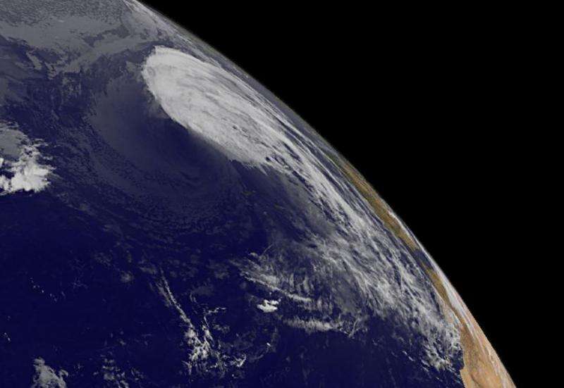
A visible image of Joaquin was taken from NOAA's GOES-East satellite on Oct. 8 at 1145 UTC (7:45 a.m. EDT) as it sped through the northern Atlantic Ocean. The image showed that most of the clouds associated with the post-tropical cyclone were northeast of the center. The image was created by the NASA/NOAA GOES Project at NASA's Goddard Space Flight Center in Greenbelt, Maryland.

Future information on this system can be found in NOAA's High Seas Forecasts issued by the National Weather Service at: http://www.opc.ncep.noaa.gov/shtml/NFDHSFAT1.shtml.
Post-tropical Joaquin continued to move rapidly toward the east at 30 knots while embedded in strong mid-latitude westerlies (winds).The National Hurricane Center expects the storm to continue weakening and turn to the southeast ahead of a trough (elongated area) of low pressure. That would take Joaquin's remnants toward Portugal and Spain over the weekend of October 10 and 11.
Provided by NASA's Goddard Space Flight Center


