RapidScat looks at Tropical Storm Henri's winds

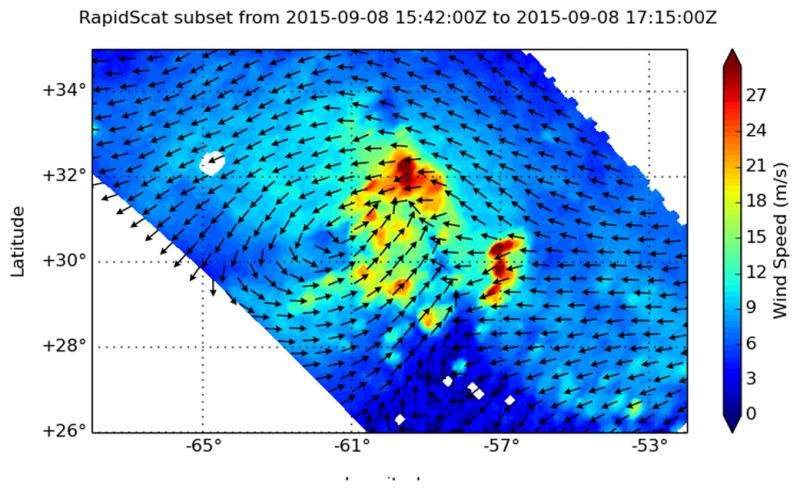
NASA's RapidScat instrument analyzed the sustained surface winds of Tropical Storm Henri on Sept. 8 as the storm was intensifying.
When the International Space Station flew over Tropical Depression 8 in the Eastern Atlantic Ocean on September 8 at 1p.m. EDT, NASA's RapidScat instrument aboard captured data on the storm's surface winds. RapidScat showed that there were tropical-storm-force winds north and east of the center near 27 meters per second (60.4 mph/97.2 kph). However, sustained winds on the west and southwestern quadrants were near 12 meters per second (26.8 mph/43.2 kph) or less.
At 11 p.m. EDT that night, Tropical Depression 8 intensified and became a tropical storm and was renamed Henri.
By 11 a.m. EDT (1500 UTC) on September 10 the center of Tropical Storm Henri was located near latitude 32.6 North, longitude 60.8 West. Henri is centered about 235 miles (375 km) east of Bermuda and 1,065 miles (1,700 km) south-southwest of Cape Race, Newfoundland, Canada.
Henri was moving toward the north near 9 mph (15 kph) is expected to continue in that direction and speed up through September 11. Maximum sustained winds were near 40 mph (65 kph) and some strengthening is forecast during the next 48 hours. The estimated minimum central pressure is 1008 millibars.
Henri may have just intensified into a tropical storm, but it's facing challenges. Southwesterly vertical wind shear and dry air were limiting the amount of thunderstorm development near the storm's center on September 10.

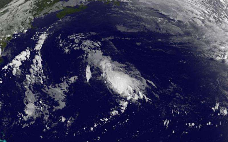
On September 10, satellite data from NOAA's GOES-East satellite showed the cloud pattern of Henri remains disorganized with most of the convection sheared off to the east and northeast of the center.
The National Hurricane Center expects that wind shear to ease as Henri moves over warm water, giving it the opportunity to strengthen in the next day or two before weakening again.
Provided by NASA's Goddard Space Flight Center


