NASA sees Tropical Storm Fred losing its punch

Tropical Storm Fred is losing its punch. Satellite imagery shows that there are no strong thunderstorms developing in the tropical storm indicating that the storm is weakening.
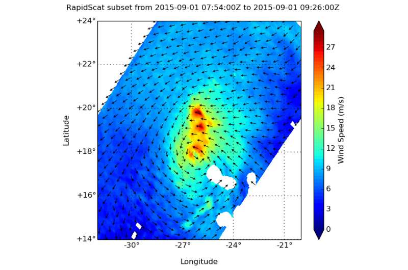
The RapidScat instrument that flies aboard the International Space Station measured Tropical Storm Fred's winds on September 1 at 4 a.m. EDT. RapidScat saw that the strongest winds tightly circled the center and were on the northern side of the storm, as strong as 24 and 27 meters per second (53.6 mph/ 86.4 kph and 60.4/97.2 kph).
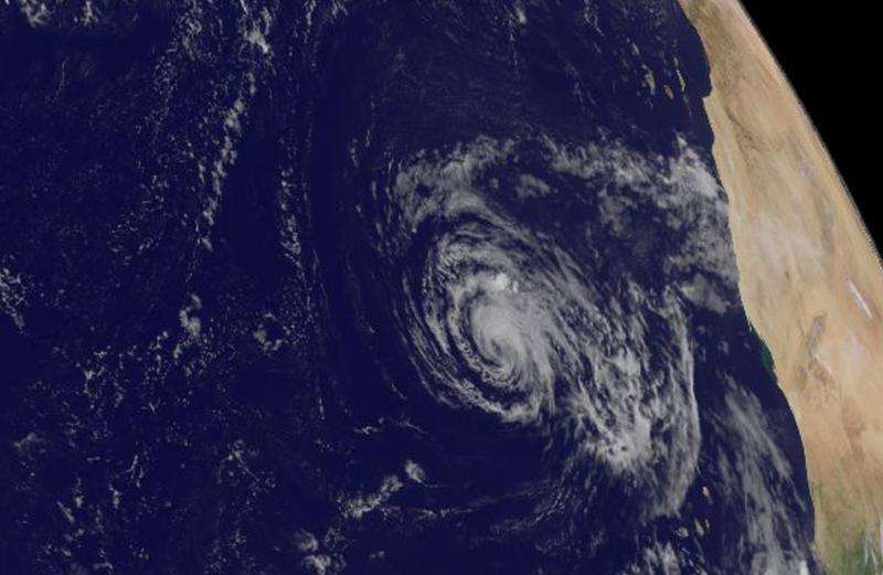
On September 1 at 13:00 UTC (9 a.m. EDT) the MODIS instrument aboard NASA's Terra satellite saw Tropical Storm Fred moving past the Cape Verde Islands. At that time, the strongest thunderstorms were northwest of the center. By September 2, those strong thunderstorms were hard to find on NOAA's GOES- East satellite imagery taken at 10:45 a.m. EDT. Both the MODIS and the GOES images were created at NASA's Goddard Space Flight Center in Greenbelt, Maryland
At 11 a.m. EDT (1500 UTC) on September 2 the center of Tropical Storm Fred was located near latitude 19.8 North, longitude 30.9 West. About 525 miles (845 km) west-northwest of the Cape Verde Islands. Fred is moving toward the west-northwest near 10 mph (17 kph), and this general motion is expected to continue over the next couple of days.
Satellite wind data indicate that the maximum sustained winds dropped to near 45 mph (75 kph) with higher gusts. Weakening is forecast during the next 48 hours. The estimated minimum central pressure is 1004 millibars.
Satellite imagery on September 2 showed that Fred had been without deep convection (strong uplift in the atmosphere that creates thunderstorms that make up a tropical cyclone) since about 11 p.m. on September 1. The National Hurricane Center noted that Fred just consists of a tight swirl of low- to mid-level clouds. NHC Forecaster Brown noted "If organized deep convection does not return very soon, which appears unlikely, Fred will become a post-tropical cyclone this afternoon. Strong westerly (wind) shear, marginal sea surface temperatures, and dry mid-level air should cause the circulation to gradually spin down during the next few days."

Fred is expected to become a post-tropical cyclone later in the day on Wednesday, September 2, 2015.
Provided by NASA's Goddard Space Flight Center


