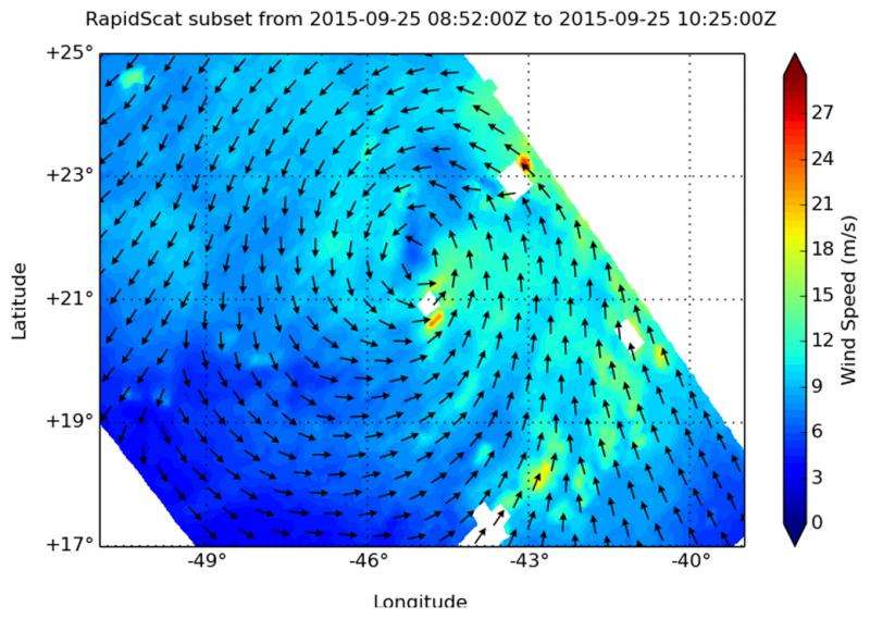
NASA's RapidScat sees the end of Tropical Storm Ida

The RapidScat instrument saw former Tropical Storm Ida's waning winds when the International Space Station passed over the remnant low pressure area on September 25, 2015.
At 6 a.m. EDT on September 25, RapidScat identified the strongest area of sustained winds in the dying storm in the southeastern quadrant of the storm where they were near 18 meters per second (40 mph/64 kph). Sustained winds around the rest of the system were a lot weaker, near 9 meters per second (20 mph/32 kph) or less.
Ida hung on for two more days after RapidScat passed overhead, and became post-tropical.
On Sunday, September 27, the National Hurricane Center stated that Ida had become a remnant low pressure area. At 5 p.m. EDT (2100 UTC), the center of Post-Tropical Cyclone Ida was located near latitude 24.5 North, longitude 48.7 West. That's about 1020 miles (1,645 km) east-northeast of the Northern Leeward Islands.The post-tropical cyclone was moving toward the west near 5 mph (7 kph). At that time, maximum sustained winds were near 30 mph (45 kph).
By Monday, September 28, 2015, the remnant low opened up into a trough (elongated area of low pressure).
Provided by NASA's Goddard Space Flight Center


