Two NASA satellites see powerful Typhoon Goni brush the Philippines

NASA's Aqua satellite and Global Precipitation Measurement (GPM) core satellite flew over Typhoon Goni as it was affecting the Philippines.
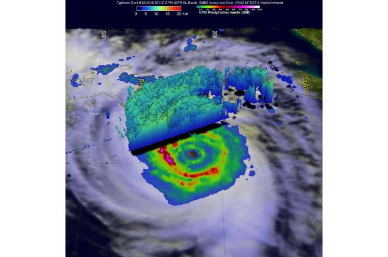
Rain bands from Typhoon Goni were hitting the island of Luzon in the northern Philippines when the GPM core observatory satellite flew over on August 20, 2015 at 0711 UTC (3:11 a.m. EDT/3:11 p.m. Philippine Standard Time). GPM's Microwave Imager (GMI) clearly showed the intensity of rain falling in Goni's inner and replacement outer eye wall. GMI found that precipitation was falling at a rate of over 88.0 (3.5 inches) in extreme rainfall south of Goni's distinct eye.
Radar reflectivity data from GPM's Dual-Frequency Precipitation Radar (DPR) instrument was used to create a 3-D view (from the east). The 3-D image showed the vertical structure of rainfall bands in the western side of the typhoon.
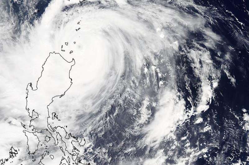
NASA's Aqua satellite flew over Typhoon Goni on August 21 at 04:50 UTC (12:50 a.m. EDT). The Moderate Resolution Imaging Spectroradiometer (MODIS) instrument aboard Aqua captured a visible image that showed the clouds from Goni's southwestern quadrant covering Luzon, Philippines.
On August 21, 2015 a number of warnings are still in effect in the Philippines as Goni continues to move away. Public storm warning signal #3 is in effect in the Batanes Group of Islands, Northern Cagayan including Babuyan and Calayan Group of Islands. Public storm warning signal #2 is in effect for the rest of Cagayan, Northern Isabela, Kalinga, Apayao, Abra and Ilocos Norte. Finally, Public storm warning signal #1 is in effect for the rest of Isabela, Ifugao, Mt. Province, Benguet, La Union and Ilocos Sur

On August 21 at 1500 UTC (11 a.m. EDT) Goni's maximum sustained winds were near 95 knots (109.3 mph/176 kph). It was centered near 19.7 North latitude and 122.3 East longitude, about 345 nautical miles (397 miles/638.9 km) south of Taipei, Taiwan. It was crawling north at 1 knot (1.1 mph/1.8 kph).
For updated forecasts from Taiwan's Central Weather Bureau, visit: http://www.cwb.gov.tw/eng/. For updated forecasts and warnings from the Japan Meteorological Agency, visit: http://www.jma.go.jp/jma/indexe.html.
The Joint Typhoon Warning Center (JTWC) predicts that the center of typhoon Goni will move north, passing east of Taiwan over the next two days (August 22 and 23). The current JTWC track takes Goni over Ishigaki Island on August 23. Ishigaki Island is the commercial hub of the Yaeyama Islands, in Japan's southwestern Okinawa Prefecture.
JTWC then forecasts Goni will move north-northeast toward the Big Island of Japan.
Provided by NASA's Goddard Space Flight Center


