NASA sees Typhoon Nangka knocking on Japan's door

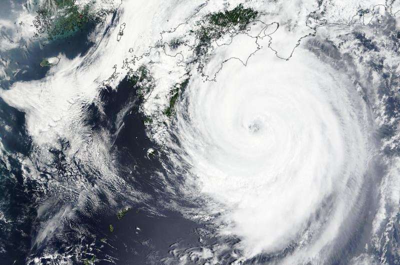
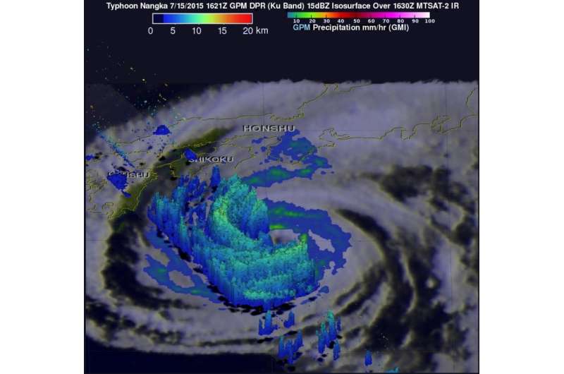
Typhoon Nangka was knocking on Japan's door when NASA's Aqua satellite passed overhead early on July 16. Satellite imagery showed that Nangka's northern quadrant began spreading over southeastern Japan. The GPM core satellite spotted towering thunderstorms in Nangka's western side.
NASA/JAXA's Global Precipitation Measurement (GPM) core observatory satellite passed above Typhoon Nangka on July 15, 2015 at 1621 UTC (12:21 p.m. EDT) as the weakening typhoon approached the Japanese island of Shikoku. GPM's Dual-Frequency Precipitation Radar (DPR) instrument revealed that the highest thunderstorm tops in Nangka's western eye wall were then reaching heights of about 12 km (7.4 miles).
On July 16 at 2:05 UTC (July 15 at 10:05 p.m. EDT) the MODIS instrument aboard NASA's Terra satellite captured a visible image of Typhoon Nangka affecting southeastern Japan. The MODIS image showed that Nangka maintained its eye and that eye was surrounded by thick, spiraling bands of thunderstorms out to about 150 nautical miles from the center making the storm over 300 nautical miles wide.
By 1500 UTC (11 a.m. EDT), Typhoon Nangka had moved to just 142 nautical miles southeast of Iwakuni, Japan, centered near 32.9 North and 134.4 East. Nangka's maximum sustained winds were down to 65 knots (75 mph/120 kph) making it a minimal category 1 typhoon. Nangka was moving to the north at 10 knots (11.5 mph/18.5 kph).
Nangka is moving north and is approaching a landfall in mainland Japan. The storm is expected to move north over Japan and rapidly weaken as it veers northeast.

Provided by NASA's Goddard Space Flight Center


