Satellite sees Hurricane Blanca develop a pinhole eye

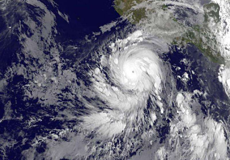
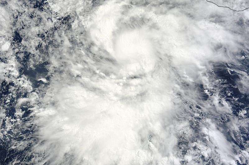
Tropical Storm Blanca strengthened into a hurricane while remaining almost stationary and about 400 miles west of the west coast of Mexico on June 3. NASA's Terra satellite captured an image of Blanca before it strengthened, while NOAA's GOES-West satellite saw the strengthening storm develop a pinhole eye.
Satellite data indicate that Blanca continues to rapidly strengthen as a small eye has become apparent in infrared imagery from NOAA's GOES-West satellite during the early morning hours today, June 3.
Blanca hasn't moved much in the last day but has continued to strengthen and during the early morning (local time) on June 3, the storm reached hurricane strength. Because of Blanca's location and proximity to the coast, the National Hurricane Center cautions that swells generated by Blanca will begin affecting portions of the coast of southwestern Mexico during the next couple of days. These swells are likely to cause life-threatening surf and rip current conditions.
NOAA's GOES-West satellite provided an infrared look at Blanca today, June 3 at 1200 UTC (8 a.m. EDT), after it strengthened into a hurricane today. The GOES image showed that Blanca had a tiny 'pinhole" eye. Hurricane force winds extend outward up to 15 miles (30 km) from the center indicative of the tiny eye. Tropical storm force winds extend outward up to 90 miles (150 km). The estimated minimum central pressure is 964 millibars (28.47 inches).
At 5 a.m. EDT (0900 UTC), the center of Hurricane Blanca was located near latitude 12.6 North, longitude 104.7 West. That's about 410 miles (655 km) south-southwest of Zihuatanejo, Mexico and 445 miles (701 km) south of Manzanillo, Mexico. The National Hurricane Center noted that Blanca is nearly stationary and is expected to move very little through tonight. The hurricane is forecast to accelerate toward the north-northwest on Thursday.

Satellite data indicate that the maximum sustained winds have increased to near 110 mph (175 km/h) with higher gusts. Rapid strengthening is forecast to continue, and Blanca is expected to become a major hurricane later today.
NHC forecaster Daniel Brown noted in the 5 a.m. EDT, June 3 discussion, "Rapid intensification is forecast to continue during the next 24 hours while Blanca remains over very warm water and in a low shear environment."
The NHC forecast track takes Blanca on a northerly track and landfall on the southern tip of Baja California by Sunday, June 7 as a tropical storm. Residents of southern Baja California and mainland Mexico should begin preparations for Blanca's arrival over the weekend.
Provided by NASA's Goddard Space Flight Center


