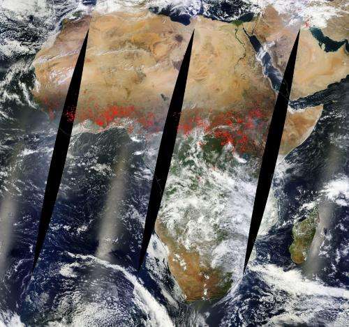
Image: Agricultural fires stretch completely across Africa

Four different passes by the Aqua satellite over the course of a day results in this stitched together image of the fires that span across central Africa. The polar orbit of the Aqua satellite takes swaths of images which are then stitched together to provide this interesting image of the continent.
Most likely these fires are agricultural in nature owing to the time of year they are occurring. This is one of Africa's agricultural seasons and farmers use fire to clear lands of unwanted plants and detritus as well as to return nutrients to the soil. While fire helps enhance crops and grasses for pasture, the fires also produce smoke that degrades air quality. In central Africa, the agricultural burning season usually runs from January, after the year's primary crops are harvested, through April or May, when the next growing season begins.
NASA's Aqua satellite collected this natural-color image with the Moderate Resolution Imaging Spectroradiometer, MODIS, instrument on January 30, 2015. Actively burning areas, detected by MODIS's thermal bands, are outlined in red.
Provided by NASA


