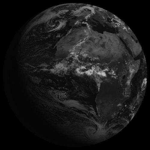
Meteosat-7 becomes EUMETSAT's longest-serving operational satellite

On 24 January 2015, Meteosat-7 becomes the longest-serving operational satellite in EUMETSAT history, clocking up 17 years of monitoring the weather from space.
Friday, 23 January 2015 - When it was launched in September 1997, Meteosat-7 was the seventh and last in the Meteosat First Generation series of satellites, but was the first solely controlled by EUMETSAT.
It was launched under the Meteosat Transition Programme (MTP) to prevent a gap in geostationary coverage, before the new generation of Meteosat satellites (Meteosat Second Generation). MTP was the first programme to be initiated by EUMETSAT, instead of ESA, and prompted the decision to set up our own ground segment.
Similar in design to its predecessors, Meteosat-7 was designated the primary operational satellite at 0° longitude in June 1998. The satellite had a design life expectancy of five years.
Met-7 facts
- Part of the MTP (Meteosat Transition Program) toward MSG (Meteosat Second Generation).
- June 1998 it became the prime satellite at 0º location.
- Last operational satellite of Meteosat First Generation.
- From 2004–2006 providing parallel services over Europe with Meteosat-8.
- July 2006 arrived at 57.5º E over the Indian Ocean.
- April 2011 became the only spacecraft providing Indian Ocean Coverage (Imaging & DCS).
IODC
An interesting development arose during Meteosat-7's period as an operational satellite. The international scientific experiment known as the Indian Ocean Experiment (INDOEX) concluded there was a need for geostationary meteorological coverage over the Indian Ocean.
EUMETSAT was the only satellite provider able fulfil this need, by moving Meteosat-5 to 63° East in 1998. Later, in 2006, Meteosat-7 was moved to provide Indian Ocean Data Coverage (IODC).
Meteosat-7 still provides coverage over the Indian Ocean, located above the Equator at longitude 57.5 °E, and some 35,800 km away.
It takes images every 30 minutes and provides a service relaying data from Data Collection Platforms (DCP), such as buoys, in support of the tsunami warning system for the Indian Ocean. It has a good viewing angle, giving a good view of cloud systems over the Arabian Peninsula.
Meteosat-7 imagery
Even before it became operational Meteosat-7 was producing some interesting imagery.
In February 1998 there was a total solar eclipse over Pacific and the Caribbean Oceans. Met-7, located at 10°W at that time, saw the event.
Fifteen years later, also in February, Meteosat-7 was perfectly positioned to spot the trail of meteor dust from the meteor which exploded close to Chelyabinsk in Russia in 2013.
Meteosat-7's future
The satellite is generally in good health, having suffered only a few anomalies over the years.
There is approx 6.38 kg of fuel available on board—3.9 kg is reserved for re-orbiting at the end of the satellite's life.
MSG Operations Platform Team Leader Flavio Murolo said: "The fuel budget and the in-orbit experience with Meteosat-5 and 6 gives sufficient confidence that Meteosat-7 should be able to support IODC until end of 2016 or possibly 1st quarter of 2017."
Met-7 re-orbiting is currently planned for April 2017.
Provided by European Organisation for the Exploitation of Meteorological Satellites (EUMETSAT)


