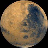
Area on Mars reveals a surface modified by water over much of planet's history

A new geologic map of part of the ancient Martian highlands produced by Scott C. Mest and David A. Crown of the Planetary Science Institute provides new insights into the planet's history of water modifying the planet's surface.
"This map depicts the complicated sequence of geologic processes that have served to modify ancient, rugged highland terrains surrounding the Hellas impact basin and shows evidence for the persistent effects of water and ice in degrading the Martian surface," Crown said.
The most prominent examples for the presence of water in this area are the canyon systems of Waikato Vallis in the north part of the map and Reull Vallis in the central part of the map. These canyons are believed to have formed when underground water was released from plains materials to the surface, causing the ground to collapse. The water could have been stored within the plains in localized aquifers or as ice, which could have melted due to the heat from nearby volcanoes.
"The canyon systems of Waikato Vallis and Reull Vallis are unlike anything we see here on Earth, so trying to understand how they formed requires us to be detectives," Mest said. "We use images and topographic data from spacecraft to map the locations of these features, evaluate their relationships to each other, and estimate their ages from superposed impact craters, then we can begin to get a better understanding of the geologic processes that modified the surface and the sequences of events that present us with the surface we see today."
Based on Viking Orbiter images, Waikato and Reull Valles were thought to have been part of one long system. However, by conducting detailed mapping using many of the newest and highest resolution data (e.g., CTX, HiRISE, THEMIS, and MOLA), Mest and Crown were able to show that these were two separate systems separated by an area of plains (Eridania Planitia). Careful estimates of the ages of the canyons and the plains reveal a sequence of events starting with the water released from Waikato Vallis, which would have been stored for a time in the plains as a shallow lake. As Reull Vallis was forming separately, the canyon breached a crater rim that was holding back the water in the lake; the lake drained gradually, which can be seen by many smaller channels incised on the floor of Reull Vallis.
In addition to these systems that dominate the landscape in this area, the plains and highland terrains contain many small channels that were carved by water flowing over the surface, likely around the same time that the canyons were forming. Lastly, most highland peaks and the walls of many impact craters show evidence that ice-rich sediments flowed downhill, forming features that resemble rock glaciers on Earth; these features represent the most recent water-related activity in the area, and may be active today.
More information: "Geologic Map of MTM -30247, -35247 and -40247 Quadrangles, Reull Vallis Region of Mars" is published as a U.S. Geological Survey Scientific Investigations Map: pubs.usgs.gov/sim/3245/
Provided by Planetary Science Institute


