NASA uses GPS to find Sierra water weight

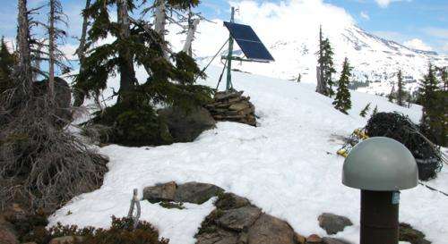
(Phys.org) —For the first time, NASA scientists have used GPS to find the total weight of winter snowpack and soil moisture in California's Sierra Nevada. The new results complement other satellite measurements and could provide a reality check for computer models used to estimate the state's water and snowpack.
A team led by Donald Argus of NASA's Jet Propulsion Laboratory, Pasadena, Calif., studied data from 1,069 GPS research sites in California, Nevada, Oregon and Washington, extending back to 2006. For each site, they averaged the difference in the ground level between October 1 (the end of the dry season) and April 1 of each year, when the snow is likely to be at its greatest weight. They then calculated how much water would be required to create the observed height changes.
On average, the yearly change in water weight between summer and winter in the Sierra Nevada of California and Klamath Mountains on the California-Oregon border was equal to 2 feet (0.6 meters) of water.
The GPS water data could help inform water managers what water resources were likely to be available after the winter or provide early warning of how dry the mountains are going to be in a fire season. They complement airborne and space missions that measure the water cycle, such as JPL's Airborne Snow Observatory and Gravity Recovery and Climate Experiment spacecraft.
"Researchers have known that up-and-down movements observed in GPS sites may be due to the weight of water, but this is the first time we've inferred the volume of water from GPS movements," said Argus. The results were published recently in Geophysical Research Letters. JPL's Yuning Fu and Felix Landerer are coauthors.
GPS receivers used for scientific research are far more precise than the commercial models found in cars and backpacks worldwide. These scientific receivers can measure changes in their location smaller than a quarter of an inch (a few millimeters).
The new study took advantage of the fact that Earth sags under the weight of water, like a mattress under a sleeping person. Also like a mattress, the sagging is localized rather than widespread, so that a heavy mountain snowfall depresses the ground beneath it but barely affects flatlands 40 to 50 miles away. GPS receivers accurately monitor the location and extent of the ground's sinking in winter and rebounding in spring.
Argus noted that the precision of the new measurement was possible because of the density of the GPS network. "The spatial resolution of GPS is only limited by the spacing of sites," he said. "In California, we are blessed with all these GPS sites that were placed here because of earthquakes. We're getting a resolution of less than 100 kilometers because that's how closely the sites are spaced."
The researchers compared the new measurement with modeled estimates, finding that NASA's widely used North American Land Data Assimilation System (NLDAS) NOAH model overestimates winter water storage in the Sierra by about 50 percent.
Argus sees many future uses for the new measurement technique. "We anticipate that GPS along with other airborne and spaceborne measurements will next be used together to improve estimates of groundwater change in California's Central Valley," he said. He hopes to use the measurement technique to create a near-real-time monitoring system for snowpack, offering another tool in the arsenal of California water managers to manage flood control, hydroelectric power generation and the state's valuable and scarce water supply.
Journal information: Geophysical Research Letters
Provided by NASA


