NASA sees Tropical Storm Raymond finally moving away from Mexico

Satellite data revealed that Raymond, formerly a hurricane, now a tropical storm is finally moving away from the coast of south-central Mexico.
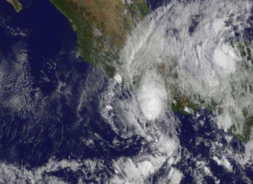
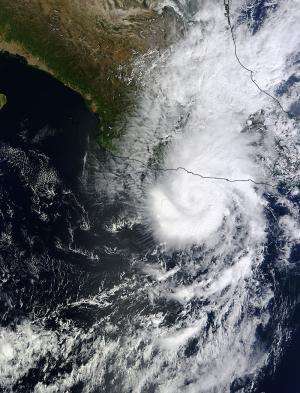
NASA's Terra satellite captured a visible image of Raymond over Mexico on Oct. 22 at 1:50 p.m. EDT when it was still a hurricane. On Oct. 23, at 11 a.m. EDT/1500 UTC, visible imagery from NOAA's GOES-West satellite showed that Raymond had moved slightly away from the Mexican coast. The image was created by NASA's GOES Project at NASA's Goddard Space Flight Center in Greenbelt, Md.
Microwave satellite imagery revealed today that Raymond has finally started to move away from coastal Mexico and head in a west-southwesterly direction. Satellite imagery also showed that a remnant mid-level circulation is now located northeast of the low-level center. Whenever the circulations at different levels of the atmosphere don't stack up, the storm's spin is affected. Imagery also showed that there was little build-up of thunderstorms near the center today, which is another indication the storm was weakening.
Despite weakening to a tropical storm, Raymond is still expected to drop more rain on the already drenched Mexican state of Guerrero today. Another 1 to 2 inches of rain, with isolated totals to 15 inches are possible. Meanwhile, as Raymond continues to linger off the coast, ocean swells continue to create large and dangerous waves along Mexico's south-central coast.
On Oct. 23, at 11 a.m. EDT, the center of Tropical Storm Raymond was located near latitude 15.4 north and longitude 103.0 west. That's about 185 miles/295 km south-southwest of Zihuatanejo, Mexico. Maximum sustained winds have decreased to near 60 mph/95 kph and the National Hurricane Center noted that some additional weakening is possible over the next couple of days.

Raymond is moving toward the west-southwest near 8 mph/13 kph and is expected to continue in that direction over the next two days, taking the storm farther away from the coast.
Provided by NASA's Goddard Space Flight Center


