NASA's SPoRT team tracks Hurricane Sandy

(Phys.org)—As Hurricane Sandy wreaked havoc on the east coast, weather experts at the Short-term Prediction Research and Transition, or SPoRT Center at NASA's Marshall Space Flight Center in Huntsville were busy developing information to help forecasters better predict the massive storm.
The SPoRT Center uses Earth Observing System measurements and other satellite data to generate products useful in the analysis of weather events. SPoRT provides these products and data sets to partners within the National Oceanic and Atmospheric Administration (NOAA), NOAA's National Weather Service, and private sector organizations like The Weather Channel.
In 2002, NASA established SPoRT, at the Marshall Space Flight Center to facilitate the use of real-time Earth Observing System measurements for short-term weather forecasting. Near real-time satellite imagery is useful for monitoring current conditions and events likely to occur in the next few hours. SPoRT provides a variety of satellite imagery and unique products from NASA and NOAA satellites such as Terra, Aqua, and the recently launched Suomi National Polar-Orbiting Partnership (Suomi NPP). These products can be useful for identifying hazards such as severe thunderstorms and tropical cyclones, fog, and snow cover, or help to monitor disasters such as floods and wildfires. SPoRT researchers also incorporate satellite observations of the land surface and profiles of atmospheric temperature and moisture within high resolution weather forecasting models with a goal of improving short-term weather predictions over the next few days.

"SPoRT has been transitioning unique NASA and NOAA research satellite data to numerous National Weather Service forecast offices for the last 10 years to help them improve short-term weather forecasts of hazardous weather conditions like hurricane Sandy," says Dr. Andrew Molthan, a research meteorologist affiliated with the project. "We work closely with end users to understand their forecast problems and match our data capabilities to those problems."
View SPoRT images of Hurricane Sandy in Flickr: www.flickr.com//photos/nasamar … 57631905749830/show/
For the last year, several additional National Weather Service Centers of Excellence including the National Hurricane Center, the Hydrometeorological Prediction Center, and the Ocean Prediction Center, have used unique multichannel satellite composite products from SPoRT. The composites are derived from NASA's Moderate Resolution Imaging Spectrometer or MODIS and the European Spinning Enhanced Visible and Infrared Imager or SEVIRI instruments to monitor large scale weather systems that pose significant weather threats to the United States.

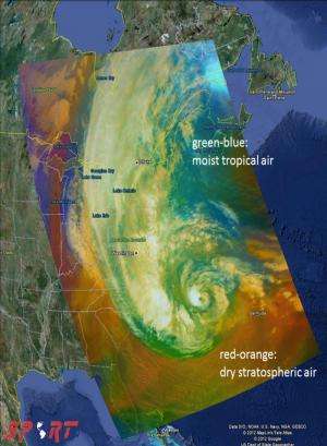
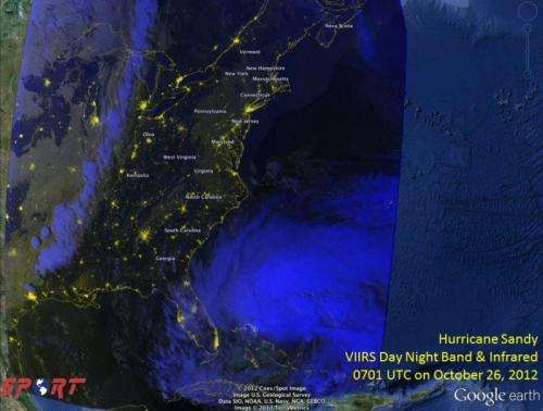
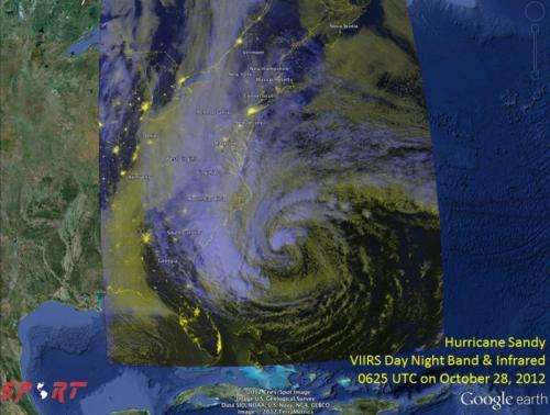
Through partnerships with NOAA's Satellite Proving Grounds, SPoRT provides additional data products from MODIS, SEVIRI, and the Visible Infrared Imaging Radiometer Suite or VIIRS instruments to monitor daily weather events, including then-Hurricane and now post-Tropical Cyclone Sandy. Forecasters are being provided imagery from multiple satellite sensors, including a recently developed "air mass" satellite product, fusing data from two instruments on the Suomi NPP satellite, to help forecasters monitor the development and decay of this storm.
"There are many MODIS and VIIRS images of Sandy available on the web, but SPoRT provides the National Weather Service with MODIS and VIIRS data directly within their decision support systems, allowing use with all of their other tools," said Molthan. "SPoRT creates a number of unique value-added products not available anywhere else."
More information:
weather.msfc.nasa.gov/sport/
nasasport.wordpress.com/
Provided by NASA


