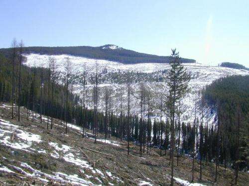
Deforestation in snowy regions causes more floods

New research suggests that cutting down swaths of forest in snowy regions at least doubles – and potentially quadruples – the number of large floods that occur along the rivers and streams passing through those forests.
For decades, the common perception in hydrology has been that deforestation in such areas made seasonal floods bigger on average, but had little effect on the number of large floods over time, said geoscientist Kim Green of the University of British Columbia. But a new study by Green and her co-author Younes Alila published today in Water Resources Research, a journal of the American Geophysical Union, suggests that deforestation consistently causes more floods – both big and small.
In the interior regions of North America, many creeks and rivers get most of their flow from melting snow accumulated during winter storms in mountainous areas. How much water flows down these streams depends not only on how much snow falls upstream, but how fast the snow melts.
But deforestation shines a new – and glaring – light on this water source. While ordinarily the trees keep the melting under control by shielding snow from the sunlight, "as soon as you get rid of the trees, the snow melts faster," said Green. "It's that simple."
The difference between Green and Alila's study and what hydrologists have historically done is how they crunched the data. In the past, hydrologists used a technique called chronological pairing – they compared each year's flood data from a stream in a deforested area to that year's data from a nearby, fully forested stream. This allowed the scientists to describe how floods become larger on average in deforested areas.
But chronological pairing doesn't deduce how much more frequent these floods might be. For this, scientists need a method called frequency pairing. In frequency pairing, researchers review a decade or more of data all at once to determine a flood's return period – how often a flood of a given size recurs.
Green's study is the first to use frequency pairing to explore how deforestation affects flood frequencies in streams in mountainous regions where at least half the annual precipitation falls as snow. She analyzed data from four creeks – Camp Creek, Redfish Creek and 240 Creek in British Columbia and Fool Creek in Colorado. With two creeks, Fool and Camp, she studied data from the past few decades in comparison to nearby, similar creeks where the terrain had not been deforested. With the other two, Redfish and 240, she used flood data generated by a computer model to study the simulated effect of deforestation of the terrain over more than 90 years. The analysis showed that, in all four waterways, deforestation turned 10-year floods into three-to-five-year floods. Twenty-year floods recurred every 10 to 12 years. Most dramatically, in 240 Creek, 50 year floods happened every 13 years, almost four times as often.
"Once you look at how the frequency has changed," Green said, "you start to realize that deforestation has had a pretty dramatic effect on floods."
Green's model for how deforestation affects the flow of water is "something that's going to be tested in other places many times, to see if their theory actually holds," said Sandy Verry, a retired U.S. Forest Service hydrologist in Grand Rapids, Minn., who was not involved in the study but has studied streams using chronological pairing in the past. Verry said he believes Green's conclusions about flood rates to be reasonable.
Until recently, the decades of data needed for frequency pairing data was scarce, Verry said, because hydrologists only started recording stream measurements in the North American West about 50 years ago. He expects there will be a "plethora" of further studies that study the frequency of floods over a broad array of deforested landscapes, including streams that flow into farmlands and cities.
"There's a whole realm of application to forest landscapes at lower elevations and flatland that this can be applied to," Verry said.
More information: "A paradigm shift in understanding and quantifying the effects of forest harvesting on floods in snow environments" Water Resources Research.
Journal information: Water Resources Research
Provided by American Geophysical Union


