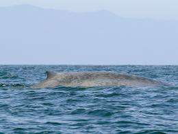
Scientists hope OSU whale-tracking data can reduce accidental deaths

(Phys.org) -- A multi-agency team of scientists has launched a project to reduce the number of whales killed from ship strikes and entanglement in fishing nets by identifying high-risk areas along the West Coast of the United States.
The WhaleWatch project will use data from the tagging and satellite monitoring of more than 300 whales, conducted by researchers at Oregon State University’s Marine Mammal Institute, and combine it with environmental data and human activities to look for areas where whales and ships are most likely to intersect – and when it is most likely to occur.
The project will involve scientists from the University of Maryland’s Center for Environmental Science and the National Oceanic and Atmospheric Administration’s National Marine Fisheries Service, as well as Oregon State.
Bruce Mate, director of the OSU Marine Mammal Institute, has led tagging studies of numerous populations of seven whale species over the past three decades. The tags can last anywhere from a few weeks to more than a year, and provide scientists with details about migration routes, feeding areas, frequency of diving and other activities.
“We hope that the study shows any propensities for risk where there is strong overlap between whale migration routes and anthropogenic activities,” said Mate, a professor of fisheries and wildlife at OSU. “We know, for example, that the West Santa Barbara Channel off California is a place where blue whales feed and it is right in the middle of shipping lanes to the Los Angeles harbor.
“Identifying the seasonal trends, as well as the geographical movement, may help policymakers find ways to better protect the whales,” Mate added. “We’re just trying to provide the science.”
Project leader Helen Bailey, of the University of Maryland Center for Environmental Science, said a number of recent net entanglements involving gray whales off California illustrates the need for the research, which is being funded by a variety of agencies and organizations.
“A first step in reducing these threats to whales is to have a better understanding of where the whales go,” Bailey said. “We will be analyzing the largest satellite tracking dataset for large North Pacific whales from Oregon State University, and combining it with satellite-derived environmental data.”
Mate has seen first-hand the results of whales’ interactions with ships. In 2007, he tagged a number of blue whales off the southern California coast during a project featured in a 2009 National Geographic Channel documentary, “Kingdom of the Blue Whale.” During the three months surrounding the field work, five blue whales were struck by ships in the immediate area and died.
“That was really sobering,” Mate said. “To see that kind of an impact on one species, in a small geographic area, really demonstrated how at-risk some species may be – and how difficult it may be for struggling populations of whales to recover.”
f
Mate and his colleagues at OSU’s Hatfield Marine Science Center in Newport, Ore., are pioneers in the use of satellites to monitor tagged whales. They most recently tracked a western gray whale named Varvara from Russia’s Sakhalin Island all the way to the breeding grounds of Mexico – and back.
As technology has improved, so has the ability to track whales during their entire migration routes.
“When we first started,” Mate recalled, “we were lucky if the tags lasted more than a month. Whales can be tough on tags, and the Pacific Ocean can be a rugged place. Now we routinely deploy tags that usually last for three or more months and show us where the whales seasonally feed, breed and birth their calves – and it is that ability to monitor through the seasons that is so important.”
The tag used by the researchers that has lasted the longest reached 620 days, on a sperm whale.
The WhaleWatch project is being funded by NASA, the U.S. Geological Survey, the National Park Service, U.S. Fish and Wildlife Service, the Smithsonian Institution, the Pacific Predators Program, NOAA, OSU, and the Office of Naval Research.
Provided by Oregon State University


