CT Scan To Help Scientists Diagnose Role of Clouds in Climate
(PhysOrg.com) -- During May and June 2009, scientists from the U.S. Department of Energy’s Brookhaven National Laboratory, Argonne National Laboratory, and the University of Colorado at Boulder will use high-tech scanners — analogous to those used in medical settings — to make observations of clouds. The research, conducted at DOE’s Atmospheric Radiation Measurement (ARM) Climate Research Facility (ACRF) in Ponca City, Oklahoma, could lead to more accurate weather forecasts and predictions about climate.
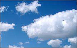
“Clouds play a critical role in Earth’s weather and climate,” said Brookhaven atmospheric scientist Dong Huang, lead researcher for this study. “But poor understanding of clouds has long limited scientists’ ability to make accurate predictions about weather and climate change.”
One major challenge is the sheer scale of the problem: Cloud processes occur on spatial scales ranging from sub-micrometers (millionths of a meter) to thousands of kilometers. The typical probes used by scientists sample a tiny volume. “Using these methods, it would take hundreds of years to take readings from an entire cloud, while the typical lifetime of a cloud is just tens of minutes,” said ARM chief scientist Warren Wiscombe, a co-investigator on this study.
To scan a larger area in a short time, the team will use a novel “cloud tomography” approach to reconstruct three-dimensional cloud structure. “Our approach is very similar to x-ray computed tomography (CT), used by doctors to diagnose disease, but this time the patients are clouds,” said Huang. A CT scanner obtains x-ray data of the body “slice by slice” using detectors that rotate around the patient. Similarly a cloud tomography system uses multiple microwave sensors to scan clouds from several distinct ground locations. The interior structure of a cloud can then be inferred from the resultant radiometric measurements using sophisticated algorithms.
The scientists will use a network of five microwave sensors to probe clouds’ thermal emission, or release of heat energy, along with two cloud radars, a variety of optical and infrared sensors, and weather balloons to measure other characteristics.
“Using this combination of instrumentation, we will be able to obtain three-dimensional ‘maps’ of the distribution of clouds, atmospheric moisture, and other characteristics over a domain of about 10 kilometers,” said Huang.
The quality of the cloud and moisture reconstructions will be evaluated using concurrent cloud measurements collected by a research aircraft operated by another field experiment led by Brookhaven atmospheric scientist Andy Vogelmann. This study will collect long-term statistics on low-optical-depth clouds.
The combined data will enable scientists to better understand the role of clouds in regulating Earth’s “radiation energy” budget — or how the planet absorbs and re-radiates energy from the sun. These data will also be used to assess the validity of how various cloud processes are represented in computer models of cloud behavior.
“The combination of intensive field experiments, long-term observations, and modeling will provide important insights that could directly benefit weather forecasting and climate modeling,” Huang said.
Provided by Brookhaven National Laboratory (news : web)


