First-of-its-kind experiment: The San Andreas Fault Gravity Gradiometer Project
Using classified technology developed by the military during the Cold War, a team of geoscientists led by Rice University's Manik Talwani is conducting a first-of-its-kind experiment on California's famed San Andreas fault this week. The researchers will gather data that could give scientists a much clearer picture of the fault's "gouge zone," a region 2-3 kilometers beneath the earth consisting of gravel-sized rock that is created when continental plates grind against one another.
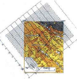
Little data has been collected on the deep underlying structures of fault lines because it's very expensive to drill deep wells and install instruments that far below ground. This week's experiments take advantage of extremely sensitive gravity instruments that will be flown over the site in an airplane. By taking to the air, Talwani and his colleagues will be able to cover a 100-square kilometer region of the San Andreas near the town of Parkfield, in central California.
"If this technique works, it will open the door for geoscientists to affordably gather information about fault lines and other subsurface areas of interest," said Talwani, the Schlumberger Professor of Geophysics. "Moreover, these flights will give us a baseline measurement that we can compare with future surveys to find out how things are changing in the shallow crust beneath the surface of the fault."
The experiments take advantage of the fact that gravity varies slightly over the Earth's surface, due to small changes in the mass of subsurface rock and sediments. Using sophisticated instruments developed for nuclear submarines during the Cold War, the research team will measure the gravity gradient, or the rate at which gravity changes from place to place along the San Andreas.
The flights are being conducted near Parkfield, because that is the site of the International Continental Drilling project, a scientific mission that's taking core samples within the region that Talwani's team is measuring. This physical evidence will help Talwani's team as it analyzes its data.
Ultimately, Talwani hopes the technology will change the economics of studying fault lines by making it affordable to conduct baseline and follow-up surveys of significant portions of fault lines -- something that just isn't cost effective with land-based instruments.
The gravity gradiometer that's being used this week was developed at great expense by Lockheed-Martin during the Cold War. It was originally developed as a silent navigation system for nuclear submarines, and some of the underlying technology of the instrument remains classified.
Talwani's group is contracting with the Houston-based Bell Geospace Inc. to carry out the airborne gradiometer survey. The project is supported by the National Science Foundation, the National Imagery and Mapping Agency and several industrial firms.
More information about the San Andreas Project is available at: cohesion.rice.edu/naturalscien … arch.cfm?doc_id=2815


